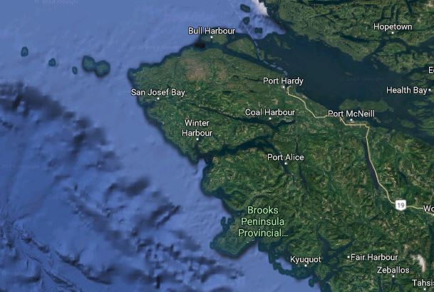
NORTH ISLAND, B.C. – Hurricane force gusts rocked the northern tip of Vancouver Island during last weekend’s windstorm.
As the storm reached its apex at around midnight Friday, Environment Canada reported wind gusts of 168 km/h on Solander Island, 165 km/h on Sartine Island, and 148 km/h at the Cape Scott Lighthouse, all of which are the equivalent of a Category 2 hurricane.
These islands, on the northwestern tip of the island, are “really exposed to winds,” according to Environment Canada meteorologist Matt MacDonald.
Here is a summary of maximum wind gusts in km/h in other regions of the North Island:
Port Hardy 81, Comox 83, McInnes Island Lighthouse 93, Estevan Lighthouse 96, Quatsino Lighthouse 11, Cape St. James 119, and Herbert Island 126.
Over the weekend, what Environment Canada described as a “strong frontal system” moved across the B.C. coast on Friday night, generating very strong winds.
According to the National Hurricane Center, winds between 96 km/h and 177 km/h are considered ‘extremely dangerous’ where “well-constructed frame homes could sustain major roof and siding damage. Many shallowly rooted trees will be snapped or uprooted and block numerous roads. Near-total power loss is expected with outages that could last from several days to weeks.”
MacDonald said Friday afternoon into early Saturday morning, the region saw a “really deep storm” track into the north end of Vancouver Island.
“This particular storm was quite a bit more intense and tracked just a little further east,” he said. “It really has to do with the storm’s trajectory depending on how much wind we’re going to see.
Asked if climate change factors into storms like the one last weekend, MacDonald said “we’ve seen storms like this before, but climate change is always there in the background, adding perhaps an extra 10 percent to the intensity of these storms.”
Storm season usually spans from December to March, MacDonald noted.
Weather in the Comox Valley and North Island has calmed, with seasonal highs of six and seven degrees and lows of three and four, and a mix of rain and sun and cloud heading into next weekend.
These conditions are downright tropical compared to Eastern Canada.
“Big troft in the jet stream that’s just allowing for cold air to descend upon them,” MacDonald said. “They just saw a really powerful nor’easter that ripped across the East Coast, there, giving anywhere from 30 to 50 centimetres of snow. It might be mild and windy out here but nothing compared to that.”


